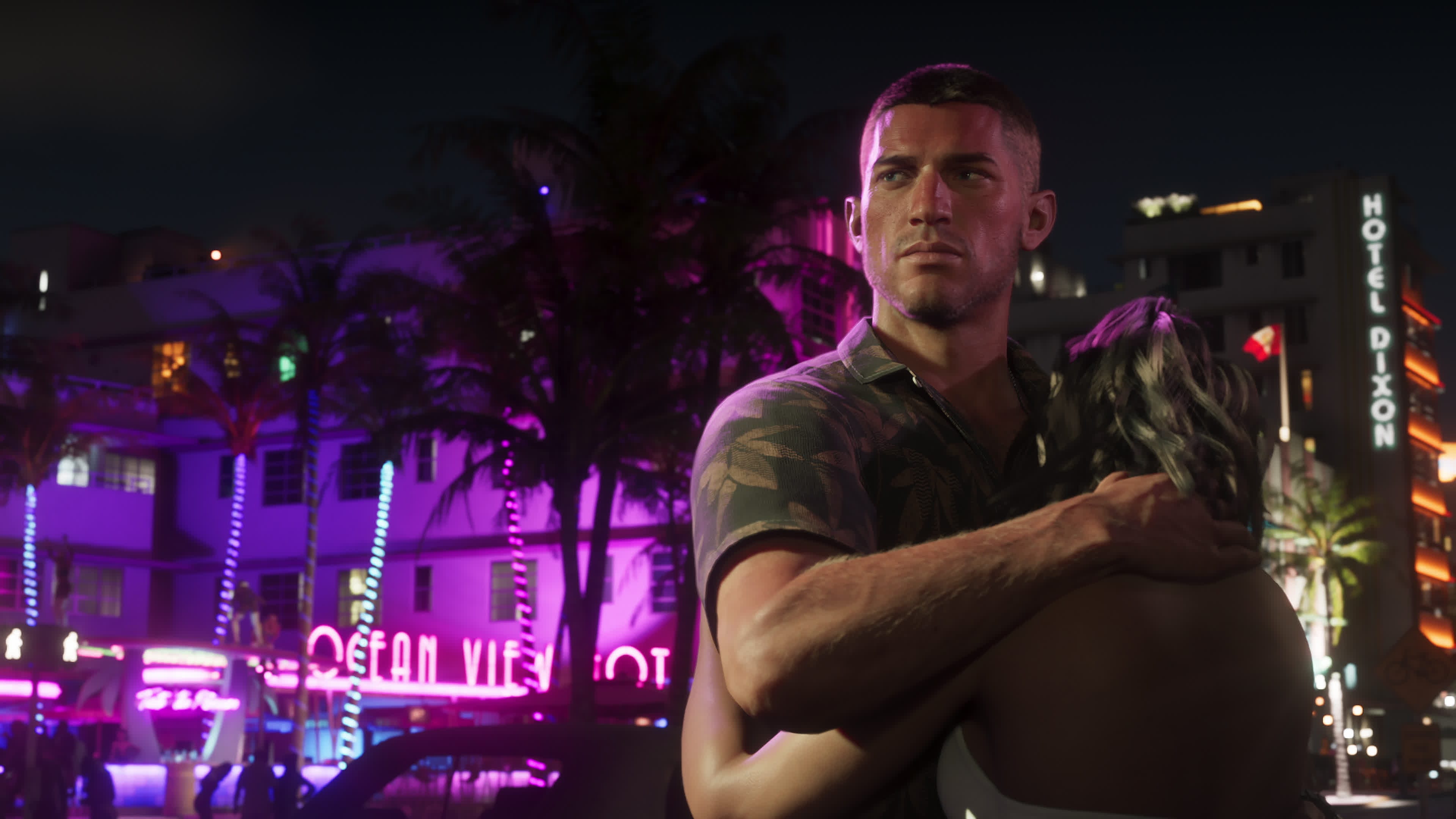
Vice City in GTA VI: confirmed map notes and likely districts
A source-led Vice City guide for GTA VI, separating what Rockstar has shown from Leonida Intel map analysis, likely districts, and launch-week watch points.
What is confirmed
Vice City is the main urban centre shown in Grand Theft Auto VI's official material. Rockstar has shown the city through trailer footage, screenshots, character material, and the official GTA VI page. As of 18 June 2026, the confirmed public baseline is still simple: GTA VI is scheduled for 19 November 2026 on PlayStation 5 and Xbox Series X|S, and no PC version has been announced.
For Vice City itself, Leonida Intel treats these points as confirmed:
- Vice City returns as part of the wider state of Leonida.
- The city includes a beachfront strip, dense road grid, nightlife areas, bridges, waterways, high-rise districts, and residential blocks.
- Rockstar has shown Vice City in daylight, at night, during traffic scenes, and in social media-style clips.
- Jason and Lucia's story clearly passes through the city, but Rockstar has not published a mission list or district-by-district gameplay breakdown.
Everything beyond that needs a label. If a claim on this page is a map read, it is Leonida Intel analysis. If it is a gameplay expectation, it is a prediction.
Why Vice City matters to the map
Vice City matters for more than nostalgia. It is the densest visible part of the public map material so far.
The trailer footage gives us several useful mapping clues: coastal roads, hotel frontage, road bridges, beach access, downtown blocks, nightlife entrances, police scenes, vehicle traffic and waterfront sightlines. None of those give exact in-game coordinates, but they do let the community line up recurring landmarks and estimate how the city is arranged.
On Leonida Intel, Vice City markers are split into:
- Confirmed locations from official material.
- Trailer-seen areas where the location exists but the exact placement is still approximate.
- Community-mapped areas where multiple analysts agree on a likely position.
- Rumoured or predicted points that need more evidence.
That separation matters. A fan map loses trust fast when every guess looks official.
Likely district structure
Rockstar has not published a named district list for Vice City. The district names below are working labels used for map organisation, source review, and guide navigation.
Beachfront and hotel strip
The beachfront is the clearest visual anchor. Trailer material shows art-deco-inspired hotels, palm-lined roads, crowds, police presence, beach activity and heavy night lighting.
Likely use on the final map:
- Tourist traffic and street scenes.
- Nightlife and police activity.
- Beach access, watercraft and social encounters.
- High-value photo and landmark markers.
Confirmed boundary: Rockstar has shown the beachfront environment.
Unconfirmed: final district name, activity list, business ownership, race routes and mission triggers.
Downtown and high-rise core
The skyline shots point to a larger city core behind the beachfront. This is where Leonida Intel expects financial buildings, corporate offices, apartment towers, parking structures and major roads to cluster.
This area is a strong candidate for heist setup, high-speed chases and story missions, but that remains prediction until Rockstar shows more.
Nightlife corridors
Vice City is built around nightlife in public footage: clubs, crowds, neon signage, traffic stops, music culture and street scenes. That does not prove a management system or property ownership loop. It does prove that nightlife is a major part of the city's identity.
Map watch points:
- Repeated club entrances.
- Street signage that appears in more than one shot.
- Police vehicle placement near crowd scenes.
- Interiors that may connect to named businesses.
Residential and working blocks
Several shots show the city away from the beachfront. Those quieter streets matter because they are more likely to connect safehouses, early missions, shops, garages and character meetings.
Leonida Intel currently treats these areas as lower-confidence map layers unless there is a direct source image or trailer timestamp attached.
What we are not calling confirmed
The following ideas are plausible, but not confirmed:
- Purchasable clubs or bars.
- A detailed drug economy.
- Dynamic territory control.
- Full public transit.
- A complete list of explorable interiors.
- Named race routes inside the city.
- Specific safehouse locations.
These may happen. They also may not. Until Rockstar publishes gameplay details or the final game is available, they stay in the analysis layer.
How to read Vice City evidence
The strongest evidence usually has more than one anchor:
- A trailer timestamp or official screenshot.
- A visible landmark, road shape, bridge, sign, skyline angle or coastline.
- A second piece of official material that supports the same placement.
- A community comparison that can be checked without relying on leaked files.
The weakest evidence is a single blurry frame, a guess based on real Miami geography, or a social post with no source attached.
What remains unknown
Rockstar has not yet confirmed the following details:
- Actual district names.
- Safehouse and garage locations.
- Shop, club, bar and service markers.
- Police stations, hospitals and transport hubs.
- Race starts and mission handoff points.
- Collectibles, hidden areas and unique encounters.
- Any differences between the pre-release fan atlas and the final map.
Bottom line
Vice City is the centre of GTA VI's public identity, but the exact city layout is still partly reconstructed from official footage. The useful job now is not to pretend every fan label is fact. It is to keep the evidence clean, update the map as Rockstar shows more, and make sure every confirmed marker can be checked.
See guide locations on the map
Track your progress, open evidence, and mark locations as discovered.
Open live map